Glossary
A
Access, Accessibility
The opportunity to reach a given end use within a certain time frame, or without being impeded by physical, social or economic barriers. Typically, accessibility is the extent to which transportation improvements make connections between geographic areas or portions of the region that were not previously well connected.
Air Quality
The cleanliness of the air; the fewer pollutants in the air, the better the air quality.
Alternative
A feasible transportation improvement that is under consideration.
Americans with Disabilities Act of 1990 (ADA)
Federal Law that requires public facilities, including transportation services, to be fully accessible for persons with disabilities.
Arterial
A major street, primarily for through traffic, usually with unlimited access to adjacent streets.
Average Daily Traffic (ADT)
The total volume of traffic in both directions on a highway during a time period of greater than one day but less than a year, then divided by the number of days for which traffic data were collected.
C
Capacity
The maximum amount of traffic on any transportation facility that can be accommodated and still function.
Categorical Exclusion (CE)
The FHWA and IDOT anticipate processing the Circle Interchange project as a Categorical Exclusion in order to satisfy NEPA requirements. Under NEPA, a Categorical Exclusion is defined as a category of actions which do not individually or cumulatively have a significant effect on the human environment ... and ... for which, therefore, neither an environmental assessment nor an environmental impact statement is required.
Collector
A road that collects and distributes traffic. Sometimes built next to an expressway to collect traffic from the area and then funnel it onto the expressway. Generally fewer lanes than an arterial.
Complete Streets
The design of roadways to safely and comfortably provide for the needs of all users, including, but not limited to, motorists, cyclists, pedestrians, transit passengers, school bus riders, commercial goods movement, persons with disabilities, seniors, and emergency users.
Conformity
The process to assess the compliance of any transportation plan, program, or project with air quality control plans. The conformity process is defined by the Clean Air Act and related amendments.
Congested Vehicle Miles of Travel
This measure indicates how many vehicle miles are traveled over the threshold for congestion conditions. If there is no congestion, then Congested VMT would be zero, however if traffic builds beyond the limit for congestion, then this measure would report the difference, or the amount causing the congestion.
Congestion Management System (CMS)
A plan developed by a Transportation Management Area (TMA) that provides for effective management of new and existing transportation facilities through the use of travel demand reduction and operational management strategies.
Containerized Cargo
Cargo is any commercial goods that are being transported. Containers are standard-size, metal boxes that carry cargo and can be moved between modes, like between a ship, railcar or truck. Container on Flatcar (COFC) and Trailer on Flatcar (TOFC) are containers or truck trailers that sit on and are transported by flatbed railcars.
CTA Blue Line
Chicago Transit Authority, also known as CTA, is the operator of mass transit within the City of Chicago, Illinois and some of its surrounding suburbs. The Blue Line consists of a 19.5-mile (31.4 km) long trunk line in the Chicago Transit Authority's rapid transit system which extends through Chicago's Loop from O'Hare International Airport at the far northwest end of the city, through downtown via the Milwaukee-Dearborn subway, and across the West Side to its southwest end at Forest Park (Congress). It is the CTA's second busiest rail line, with an average of 161,191 passengers boarding each weekday in 2011. The route's full length is 34.6 miles (55.7 km) with a total of 33 stations
D
Demographics
Descriptive characteristics of populations. Examples include age, race and ethnicity, gender, income, employment and household status.
Destination
The place where a trip ends.
E
EL
The 'L' (sometimes written, "L", El, EL, or L, short for "elevated" is the rapid transit system serving city of Chicago, in the U.S. state of Illinois, and some of its surrounding suburbs.
Environment
Surrounding conditions or circumstances, including both the natural and built environment.
Environmental Justice
An Executive Order requiring to the greatest extent possible allowed by law, administer and implement its federal programs, policies, and activities that affect human health or the environment so as to identify and avoid disproportionately high and adverse effects on minority and low-income populations.
Environmental Mitigation
Methods, strategies or actions to reduce the negative (direct, indirect and/or cumulative) effects of a transportation project on the environment.
Expressway/Freeway
A controlled-access, divided highway for through traffic. Intersections with other roads are separated by different road levels.
F
Federal Highway Administration (FHWA)
Division of the U.S. Department of Transportation that oversees and funds highway planning and programs.
Freeway/Expressway
A controlled-access, divided highway for through traffic. Intersections with other roads are separated by different road levels.
Freight
Commercial goods carried by a vehicle, usually a truck, plane, train or ship; also known as cargo.
Forecast
A calculation or estimate of future conditions.
Functional Classification
A method of cataloging a road's purpose and design. Roads are generally classified as Interstates, Freeways / Expressways, Arterials (principal or minor, urban or non-urban), Collectors (major or minor, urban or non-urban), and local roads (urban or non-urban).
H
Highway
Term used to describe higher capacity roads; also includes rights of way, bridges, railroad crossings, tunnels, drainage structures, signs, guardrails, and protective structures in connection with highways.
Human Capital
The skills, competencies, and knowledge embodied in the ability to perform work that produces economic value.
I
IDOT Division of Highways
The Division of Highways is responsible for planning, designing, constructing, operating and maintaining a safe highway system that links the state together. They also work with local governments to ensure that the system accommodates local community development priorities and respects the needs of alternative local modes of transportation.
IDOT Division of Public and Intermodal Transportation
The Division of Public and Intermodal Transportation develops, implements, and advocates for policies and practices that promote safe, efficient, affordable, reliable, and coordinated mass and rail transit.
IDOT Division of Traffic Safety
This division is responsible for highway safety activities and compiles crash data and evaluates and analyzes the information to identify highway improvements in problem areas.
Infrastructure
A term connoting the physical underpinnings of society at large, including, but not limited to, roads, bridges, transit, water and waste systems, public housing, sidewalks, utility installations, parks, public buildings and communication networks.
Intelligent Transportation Systems (ITS)
The collection, storage, processing, and distribution of information relating to the movement of people and goods, including systems for traffic management, public transportation management, emergency management, traveler information, advanced vehicle control and safety, commercial vehicle operations, electronic payment, and railroad grade crossing safety.
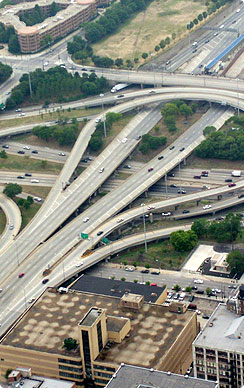
Interchange
An interchange is a road junction that typically uses grade separation, and one or more ramps, to permit traffic on at least one highway to pass through the junction without directly crossing any other traffic stream.
Interstate System
The system of highways that connects the principal metropolitan areas, cities, and industrial centers of the United States. The Interstate System also connects the US to internationally significant routes in Mexico and Canada. The routes of the Interstate System are selected jointly by the state department of transportation for each state and the adjoining states, subject to the approval of the US Secretary of Transportation.
L
Land Use
Refers to how land and the structures (development) on it are used, i.e., commercial, residential, retail, industrial, etc.
Level of Service (LOS)
A qualitative measure describing operational conditions and the perception of transportation users of the existing conditions. Generally using six levels of service ranging from A to F, with level of service A representing the best operating conditions and level of service F the worst. Initially used to define the road network, the concept has been expanded to include bicycle and pedestrian conditions.
Local Street
A low-volume, high-access road intended solely for access to adjacent properties.
M
Major Investment
A "high-type highway or transit improvement of substantial cost that is expected to have a significant effect on capacity, traffic, level of service or mode share at the transportation corridor or sub-area scale."
Map-21
Moving Ahead for Progress in the 21st Century (MAP-21) is the latest Federal highway bill which will modernize and reform our current transportation system to help create jobs, accelerate economic recovery, and build the foundation for long-term prosperity. MAP-21 focuses the highway program on key outcomes, such as reducing fatalities, improving bridges, fixing roads, and reducing congestion, in order to ensure that taxpayers are receiving the most for their money. States will set their own targets for improving safety, road and bridge condition, congestion, and freight movement.
Metropolitan Planning Organization (MPO)
Formed in cooperation with the state, the Metropolitan Planning Organization (MPO) develops long range transportation plans and transportation improvement programs for metropolitan area greater than 50,000 in population. The MPO for the Chicagoland area is the Chicago Metropolitan Agency for Planning (CMAP).
Metropolitan Statistical Area (MSA)
Census Bureau delineation for major metro areas in the U.S. Also includes standard (SMSA) and consolidated metropolitan statistical area (CMSA).
Mobility
The ability to move or be moved from place to place. Typically, mobility is the ease with which movement can occur between geographic areas or parts of the region.
Mode, Intermodal, Multimodal
Forms of transportation, such as personal motorized vehicle, public transit, bicycling and walking. Intermodal refers to the connections between modes, and multi-modal refers to the availability of transportation options within a system or corridor.
N
National Environmental Policy Act (NEPA)
The federal law that governs the preparation of an Environmental Impact Statement (EIS), Environmental Assessment (EA), or Categorical Exclusion (CE).
Network
A graphic and/or mathematical representation of multimodal paths in a transportation system.
Non-Motorized
Non-motorized transportation, also known as active transportation and human powered transportation, includes walking and bicycling, as well as small-wheeled transport (skates, skateboards, push scooters and hand carts) and wheelchair travel.
O
Operations, Operational Strategies
How a transportation network functions; operational strategies are techniques that influence how a network functions. For example, traffic signals and signs are operational activities that control traffic.
P
Peak Period
The time period, usually in the morning and afternoon, when demand for transportation is high.
Public Participation
The active and meaningful involvement of the public in the development of transportation plans and improvement programs.
Public Road
Any road or street under the jurisdiction of and maintained by a public authority and open to public traffic.
Public Transit (or Transportation)
Generally refers to passenger service provided to the general public along established routes with fixed or variable schedules at published fares. Related terms include transit, mass transit, public transportation or paratransit. Transit modes include commuter rail, heavy or light transit, bus, or other vehicles designated for commercial transportation of non-related persons.
Pump Station
A facility for pumping fluids from one place to another and can be used for a variety of purposes such as the supply of water to canals, the drainage of low-lying land, and the removal of sewage to processing sites.
Purpose and Need
The Purpose and Need incorporates detailed technical analysis and public involvement findings to date to define the purpose of the project and the need for the improvements.
Q
Quality of Life
A term used to describe the lifestyle conditions of an area. Conditions include the scale and depth of opportunities or choices in housing, employment, transportation, the natural environment, education, health care, and recreational and entertainment activities.
R
Ramp
A sloping, sometimes curved road, etc. joining different levels.
S
Single Occupant Vehicle (SOV)
A SOV is a vehicle that carries only one occupant (the driver) to a destination.
Socioeconomic
A term used to describe social and economic factors, generally resulting from an analysis of demographics of a population.
Stakeholder Involvement
A process that will facilitate effective identification and understanding of the (SIP) concerns and values of all stakeholders as an integral part of the project development process. It includes a formal written plan explaining how public input and comments will be obtained.
Stakeholder Involvement Plan (SIP)
The SIP is a blueprint for defining methods and tools to educate and engage all stakeholders in the decision-making process for a project. The SIP provides the framework for achieving consensus and communicating the decision-making process between the general public, public agencies, and governmental officials to identify transportation solutions for the project.
Sustainability
Address present and future needs while not harming the natural resources and unique human-environmental systems, including air, water, land, energy, and human ecology and/or those of other sustainable systems.
T
Transportation (or Travel) Demand Management (TDM)
Strategies and collective efforts designed to achieve reductions in vehicular travel demand. In general, TDM does not require major capital improvements. It includes ridesharing, land use policies, employer-based measures, and pricing/subsidy policies.
Transportation Improvement Program (TIP)
This is a document prepared by states and MPOs citing projects to be funded under federal transportation programs, typically for a three to five year period. Without TIP inclusion, a project is ineligible for federal funding.
Travel Time
Customarily calculated as the time it takes to travel from "door-to- door." In transportation planning, the measures of travel time include time spent accessing, waiting, and transferring between vehicles as well as time spent traveling.
Transit
Generally refers to passenger service provided to the general public along established routes with fixed or variable schedules at published fares. Related terms include public transit, mass transit, public transportation or paratransit. Transit modes include commuter rail, heavy or light transit, bus, or other vehicles designated for commercial transportation of non-related persons.
Transit Dependent
Persons who must rely on public transit or paratransit services for most of their transportation. Typically refers to individuals without access to a personal vehicle.
Transit Oriented Development (TOD)
The development of compact, mixed use, walkable communities centered around high quality transit systems/stations.
U
Urbanized Area
Area that contains a city of 50,000 or more population plus incorporated surrounding areas meeting set size or density criteria.
U.S. Department of Transportation (DOT)
The principal direct federal funding and regulating agency for transportation facilities and programs. FHWA and FTA are units of the US DOT.
Utility Tunnels
An underground space or passageway completely enclosed except for the openings and is used for items such as conduits, pipes, wires and other transmissions used in the delivery of utilities with enough room for a human to enter. The construction of utility tunnels declined in the late 20th century.
V
Vehicle Hours of Travel (VHT)
The sum of time all vehicles spend traveling, calculated most typically over a 24-hour period. This statistic is most commonly summed over some area like county but can also be calculated for specific routes or trip purposes like work.
Vehicle Miles of Travel (VMT)
A standard area-wide measure of travel activity. The most conventional VMT calculation is to multiply the average length of trip by the total number of trips.
Viaduct
A viaduct is a bridge composed of several small spans. Viaducts may span land, roadways or other transportation facilities.


